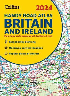
2024 Collins Handy Road Atlas Britain and Ireland: A5 Spiral
De (autor): Collins
This easy-to-use, handy A5 sized road atlas with popular lie-flat spiral binding features extremely clear route planning maps of Britain and Ireland and fits neatly into your glove box or bag. The atlas has been fully updated. The maps of Britain are at 9.9 miles to 1 inch (1:625,000) and the whole of Ireland is covered at 15.8 miles to 1 inch (1:1,000,000). There are also a selection of more detailed urban area maps at 4.5 miles to 1 inch (1:285,000) to aid route planning in these busy areas. Main features
- Road maps that focus on the main roads, motorways and settlements.
- More detailed maps of London, Manchester, Merseyside and West Midlands.
- Park & Ride locations (for bus and rail).
- Handy distance calculator chart highlighting distances between the major towns.
-10%
transport gratuit
PRP: 61.94 Lei
Acesta este Pretul Recomandat de Producator. Pretul de vanzare al produsului este afisat mai jos.
55.75Lei
55.75Lei
61.94 LeiPrimesti 55 puncte

Primesti puncte de fidelitate dupa fiecare comanda! 100 puncte de fidelitate reprezinta 1 leu. Foloseste-le la viitoarele achizitii!
Livrare in 2-4 saptamani
X
Pentru a putea comanda rapid este nevoie sa introduceti numarul dvs de telefon in formatul 0xxxxxxxxx (10 cifre).Un operator Libris.ro va suna si va cere telefonic restul datelor necesare.
Descrierea produsului
This easy-to-use, handy A5 sized road atlas with popular lie-flat spiral binding features extremely clear route planning maps of Britain and Ireland and fits neatly into your glove box or bag. The atlas has been fully updated. The maps of Britain are at 9.9 miles to 1 inch (1:625,000) and the whole of Ireland is covered at 15.8 miles to 1 inch (1:1,000,000). There are also a selection of more detailed urban area maps at 4.5 miles to 1 inch (1:285,000) to aid route planning in these busy areas. Main features
- Road maps that focus on the main roads, motorways and settlements.
- More detailed maps of London, Manchester, Merseyside and West Midlands.
- Park & Ride locations (for bus and rail).
- Handy distance calculator chart highlighting distances between the major towns.
Detaliile produsului
De pe acelasi raft
De acelasi autor
Parerea ta e inspiratie pentru comunitatea Libris!


