


To the Ends of the Earth: How the Greatest Maps Were Made
To the Ends of the Earth: How the Greatest Maps Were Made
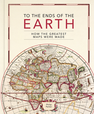
- Drawing tools and materials: from Babylonian maps carved in clay, to digital maps created via touchscreen
- The introduction of various mapping conventions and key components of a map: from Ptolemy's introduction of longitude and latitude, through the 13th century origins of having north at the top, to the various projections used to represent the Earth. With visually stunning historic maps and antique instruments, this book will engross readers with its fascinating stories of how we came to chart our world.
PRP: 217.00 Lei
Acesta este Pretul Recomandat de Producator. Pretul de vanzare al produsului este afisat mai jos.
195.30Lei
195.30Lei
217.00 LeiPrimesti 195 puncte

Livrare in 2-4 saptamani
Descrierea produsului
- Drawing tools and materials: from Babylonian maps carved in clay, to digital maps created via touchscreen
- The introduction of various mapping conventions and key components of a map: from Ptolemy's introduction of longitude and latitude, through the 13th century origins of having north at the top, to the various projections used to represent the Earth. With visually stunning historic maps and antique instruments, this book will engross readers with its fascinating stories of how we came to chart our world.
Detaliile produsului
De pe acelasi raft
-

PRP: 248.00 Lei
223.20 Lei
223.20 Lei248.00 Lei
-
PRP: 217.00 Lei
195.30 Lei
195.30 Lei217.00 Lei
-
PRP: 206.11 Lei
185.50 Lei
185.50 Lei206.11 Lei
-
PRP: 697.50 Lei
627.75 Lei
627.75 Lei697.50 Lei
-
PRP: 185.93 Lei
167.34 Lei
167.34 Lei185.93 Lei
-
PRP: 114.75 Lei
103.28 Lei
103.28 Lei114.75 Lei
-
PRP: 173.60 Lei
156.24 Lei
156.24 Lei173.60 Lei
-
PRP: 520.73 Lei
468.66 Lei
468.66 Lei520.73 Lei
-
PRP: 217.00 Lei
195.30 Lei
195.30 Lei217.00 Lei
-
PRP: 167.34 Lei
150.61 Lei
150.61 Lei167.34 Lei
-
PRP: 1482.32 Lei
1334.09 Lei
1334.09 Lei1482.32 Lei
-
PRP: 130.86 Lei
117.77 Lei
117.77 Lei130.86 Lei
-
PRP: 1423.42 Lei
1281.08 Lei
1281.08 Lei1423.42 Lei
-
PRP: 130.86 Lei
117.77 Lei
117.77 Lei130.86 Lei
-
PRP: 306.44 Lei
275.80 Lei
275.80 Lei306.44 Lei
-
PRP: 92.94 Lei
83.65 Lei
83.65 Lei92.94 Lei
De acelasi autor
-
PRP: 248.00 Lei
223.20 Lei
223.20 Lei248.00 Lei
-
PRP: 204.00 Lei
183.60 Lei
183.60 Lei204.00 Lei
-
PRP: 247.69 Lei
222.92 Lei
222.92 Lei247.69 Lei
-
PRP: 288.97 Lei
260.07 Lei
260.07 Lei288.97 Lei
-
PRP: 297.54 Lei
267.79 Lei
267.79 Lei297.54 Lei
-
PRP: 136.34 Lei
122.71 Lei
122.71 Lei136.34 Lei
